Maharashtra, India’s second-most populous state and a major economic powerhouse, is divided into 36 administrative districts organized into six revenue divisions. Whether you’re a student, researcher, traveler, or business professional, having an accurate and visually appealing map of Maharashtra’s districts is essential.
Maharashtra State 3D Political Map Download
Maharashtra State Political Map (3D View): High-Resolution Download
Discover Maharashtra: Political 3D Map Download (Historical & Current Boundaries
Detailed 3D Political Map Maharashtra: Downloadable Vector & PNG Files
Free Download: Detailed Political Map of Maharashtra State (PDF/JPG)
In this post, we offer free downloadable maps of Maharashtra districts in high-resolution formats. These include:
- Classic political district maps
- Modern, vibrant redesigns with bright colors
- Premium 3D-style maps with realistic depth, gradients, shadows, and terrain effects
All maps maintain full geographic accuracy, clear borders, and Marathi/English labels for easy reference.
Why Download Maharashtra District Maps?
Maharashtra spans over 307,713 square kilometers and features diverse landscapes—from the Western Ghats to the Deccan Plateau and the Arabian Sea coastline. Accurate district maps help with:
- Education & Research: Perfect for school projects, competitive exams (UPSC, MPSC), or geography studies
- Business & Planning: Useful for market analysis, logistics, real estate, or tourism planning
- Travel & Exploration: Identify districts like Mumbai, Pune, Nagpur, or tourist hotspots in Ratnagiri and Sindhudurg
- Professional Use: High-quality visuals for presentations, reports, websites, or infographics
These maps are updated for 2025, reflecting the current 36 districts (no new districts added since Palghar in 2014).
List of Districts in Maharashtra (2025)
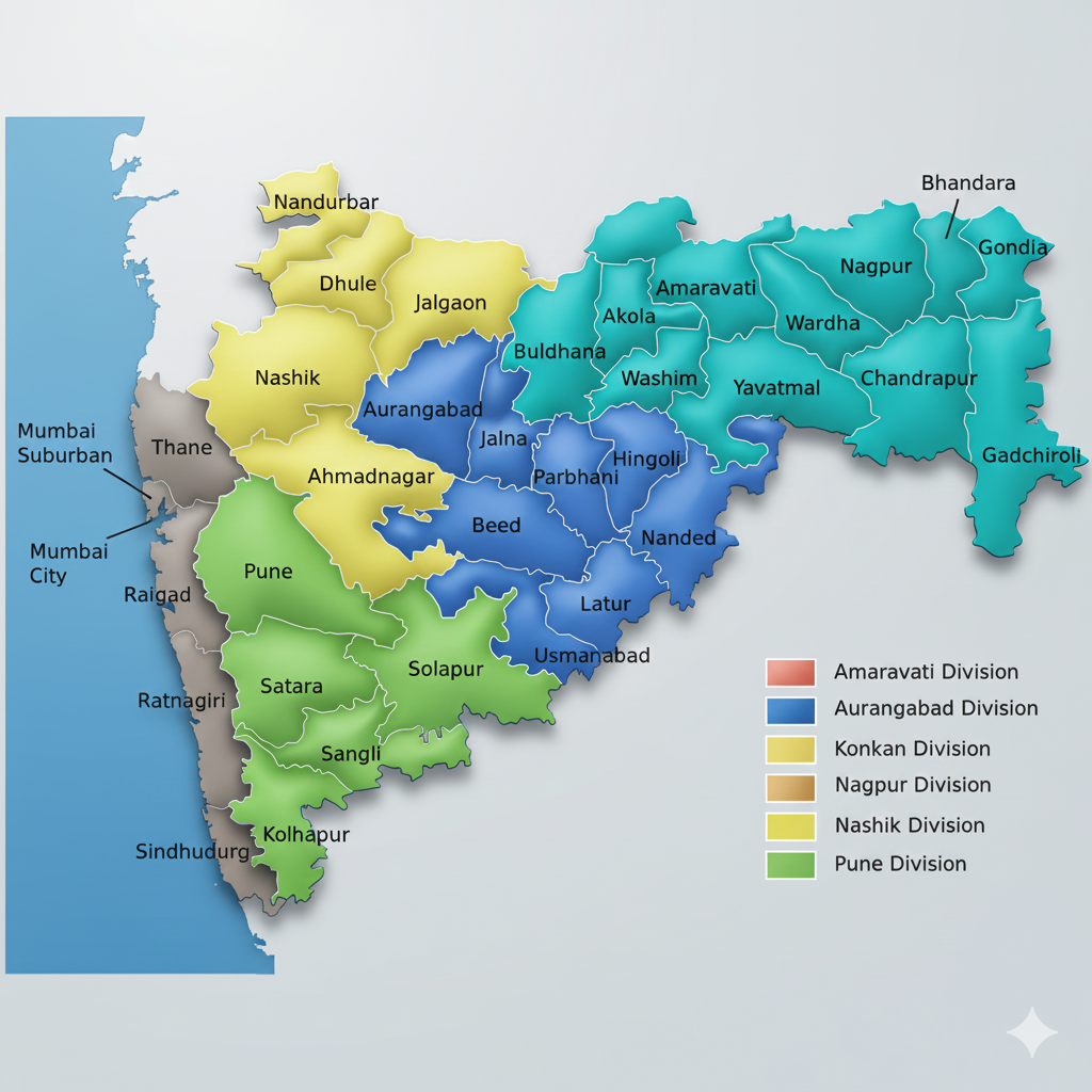
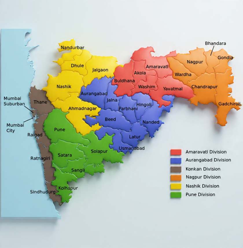
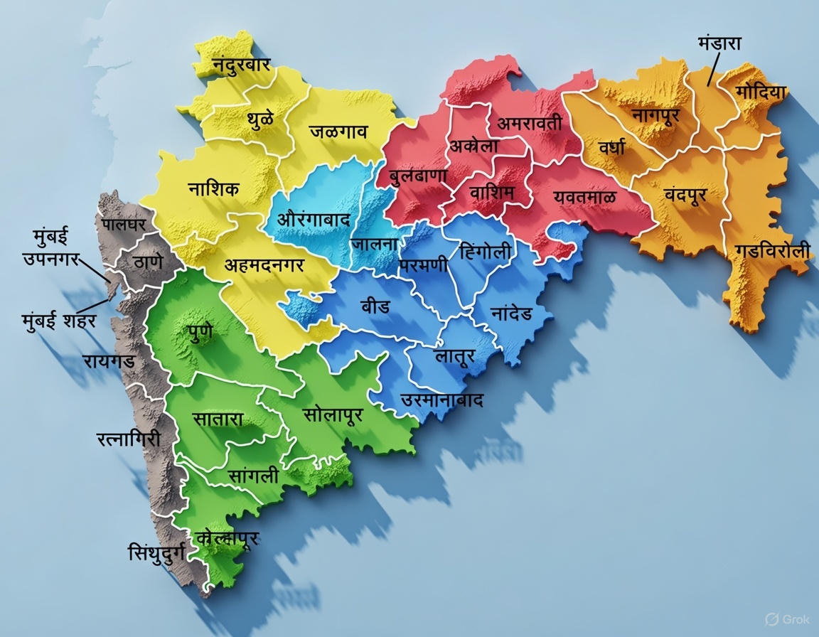
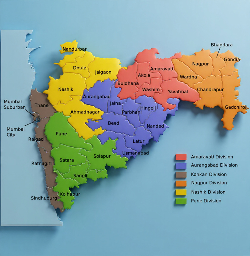
Maharashtra has 36 districts grouped into six administrative divisions:
- Konkan Division: Mumbai City, Mumbai Suburban, Palghar, Raigad, Ratnagiri, Sindhudurg, Thane
- Nashik Division: Ahmednagar, Dhule, Jalgaon, Nandurbar, Nashik
- Pune Division: Kolhapur, Pune, Sangli, Satara, Solapur
- Aurangabad Division: Aurangabad, Beed, Jalna, Osmanabad, Nanded, Parbhani, Hingoli, Latur
- Amravati Division: Akola, Amravati, Buldhana, Washim, Yavatmal
- Nagpur Division: Bhandara, Chandrapur, Gadchiroli, Gondia, Nagpur, Wardha
Key highlights:
- Largest district by area: Ahmednagar (~17,000 sq km)
- Most populous: Thane (over 11 million residents)
- Capital: Mumbai (financial hub of India)
Free Downloadable Maharashtra Maps
We’ve redesigned traditional maps with modern aesthetics for better clarity and engagement. These feature:
- Bright, rich colors with vivid greens, blues, and warm earth tones
- Smooth gradients and soft shadows for a premium look
- Subtle 3D depth effects, realistic lighting, and terrain textures (in select versions)
- Clean contrasts and readable labels
1. Classic High-Resolution Maharashtra District Map
A clean, traditional political map showing all 36 districts with clear boundaries and labels.
2. Modern Vibrant Maharashtra District Map
Bright, lively colors with improved visibility—ideal for digital use, presentations, or websites.
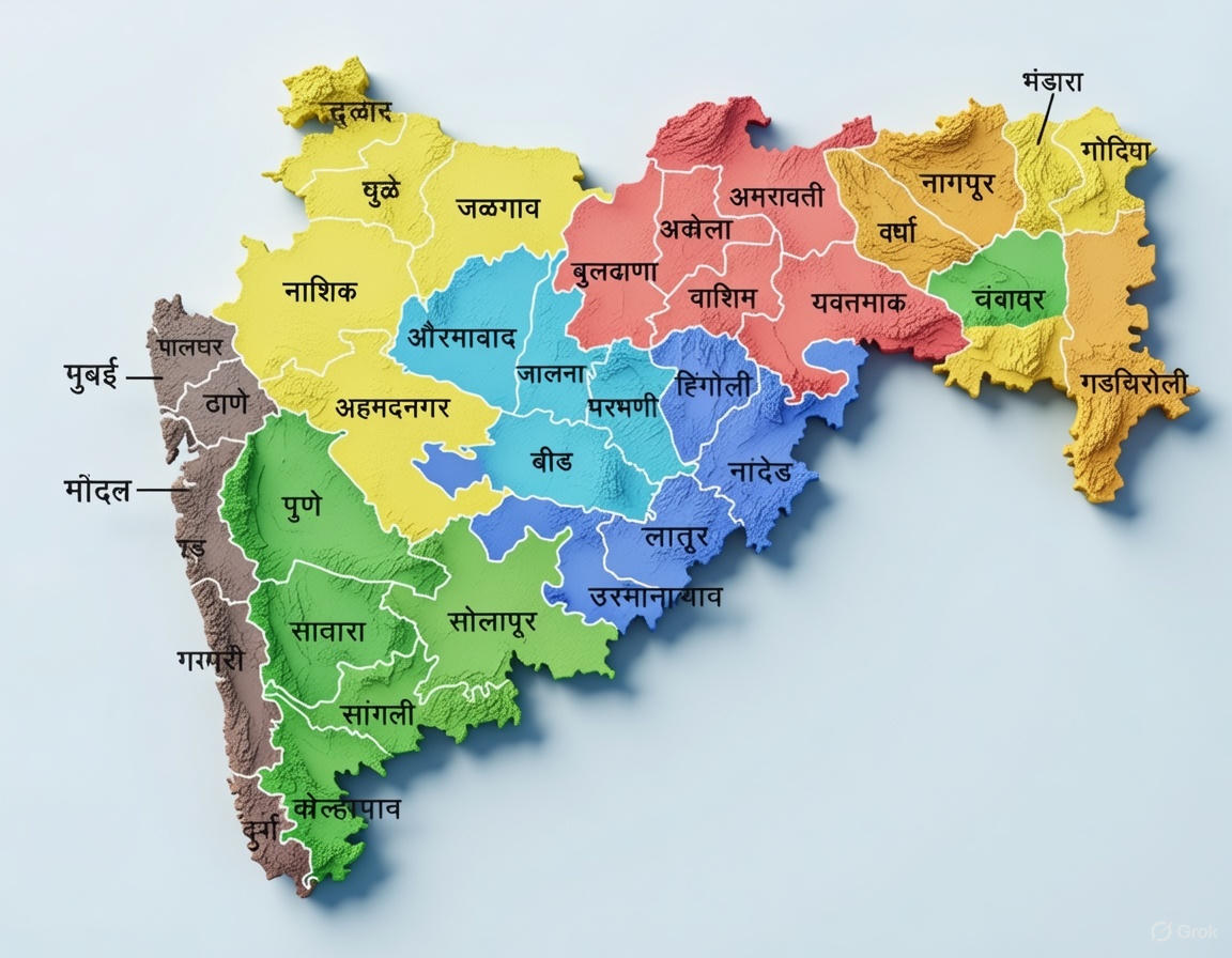
3. Premium 3D-Style Maharashtra District Map
Advanced redesign with realistic elevation, depth layering, and immersive textures for a high-end cartographic feel.
Note: These maps are provided for personal, educational, and non-commercial use. For commercial purposes, please contact us.
How to Use These Maps
- Download your preferred version (high-res PNG/JPG)
- Use in documents, blogs, or social media (credit appreciated)
- Embed on websites for educational or informational purposes
If you need custom edits or vector formats, let us know in the comments!
FAQs About Maharashtra Districts
How many districts are in Maharashtra in 2025? 36 districts, unchanged since 2014.
What are the six administrative divisions of Maharashtra? Konkan, Nashik, Pune, Aurangabad, Amravati, and Nagpur.
Which is the largest district in Maharashtra? Ahmednagar by area; Thane by population.
Can I use these maps for commercial projects? Free for personal/educational use. Contact for licensing.
Ready to explore Maharashtra’s geography? Download your free maps today and stay updated with our latest cartography resources!
Last updated: December 23, 2025 Share this post if it helped you!
Great content! Keep up the good work!